 Pristupačnost
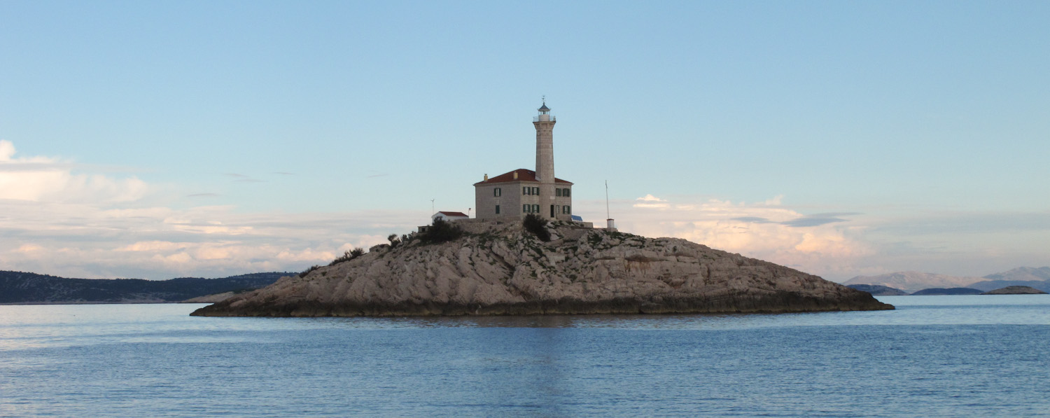
Upwelling has significant consequences for marine life because the upward motion transports nutrient-rich deep water closer to the surface, and thus stimulates primary production and the development of higher levels of the food web. Biological research in the 1980s linked an abundance of plankton, zones of sardine spawning and large catches in the region of Blitvenica Island to upwelling of subsurface water from the Jabuka Pit.
Modelling results and satellite measurements of sea surface temperature (SST) suggested that upwelling takes place at the eastern coast of the Middle Adriatic due to wind forcing, at the Albanian coast due to bora, and at the western coast due sirocco. Research undertaken by scientists who form a large part of the MAUD project team has diagnosed strong diurnal upwelling and downwelling at the Lastovo Island, and has ascribed it to island trapped waves resonantly forced by tides and land-sea breezes.

The final goal of the MAUD project is to create an integral picture of upwelling and downwelling (U/D) of water masses in the Middle Adriatic, specifically in the wider area of Jabuka and Blitvenica Islands and the connecting region. The proposed project is based on several preliminary studies done by the associates on this project. Long-term measurements of sea temperature, taken in order to explain extremely rich vegetation of benthos algae specific to Jabuka and Blitvenica Islands, suggest that (i) seasonal warming in this area is impeded by upwelling, (ii) there are significant differences between Jabuka and Blitvenica Islands and (iii) there is a pronounced interannual variability.
During May 2017 an undulating vehicle was used to take intensive measurements of hydrographic properties with a high spatial resolution in this area. Analysis of the obtained fields has pointed to a complex structure, which suggests spatially localized upwelling probably related to the complex bathymetry of the area.
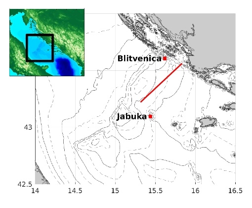
The proposed project covers empirical research and numerical modelling. The former comprises continuous measurements at Blitvenica and Jabuka Islands, intensive measurements during two cruises, and numerical and laboratory data analysis. Modelling will be used to perform realistic simulations of U/D in the Middle Adriatic and quasi-realistic simulations for the entire Adriatic. Synoptic situations typical for this area will be assessed from meteorological data and ALADIN model outputs and those favourable for U/D will be identified. Analysis of satellite SST measurements will determine regions of upwelling in the Adriatic and investigate interannual variability. Long-term measurements of temperature in a water column, sea level and dissolved oxygen (DO) will be undertaken at Jabuka and Blitvenica Islands and they will serve to identify U/D, define time scales and intensity, allow a more detailed study into the dynamics of U/D in connection to local sea level changes, and attempt to determine the effect of U/D on DO concentration. During the two spring cruises in the Blitvenica and Jabuka waters as well as in the connecting region, continuous measurements of hydrographic properties with a high spatial resolution from the surface to a 50 m depth, sea currents with a vessel-mounted ADCP and meteorological parameters will be performed. Classical CTD measurements will be carried out at stations determined by adaptive planning in order to document the deeper layers. Analysis of these data will provide information on the spatial structure of U/D and scrutiny of the results from the three cruises (one preliminary and two within the framework of this project) will allow for interannual variability.
Recorded U/D will be reproduced by realistic simulations with the ROMS model with an array of nested domains of differing spatial resolutions, the highest of which will be chosen so as to allow for the complex bathymetry of the area. Atmospheric forcing will be taken from the ALADIN model and the results of schematic and realistic ROMS simulations will be used to interpret the data. The SCHISM model will be used to determine U/D regions in the Adriatic influenced by prevailing winds.
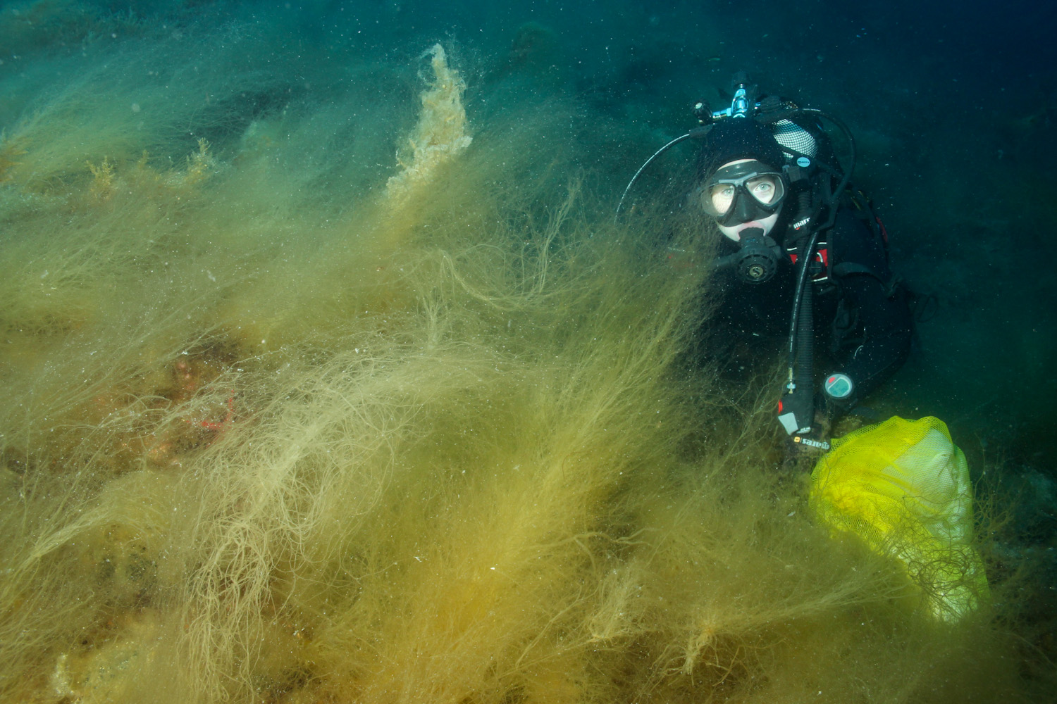
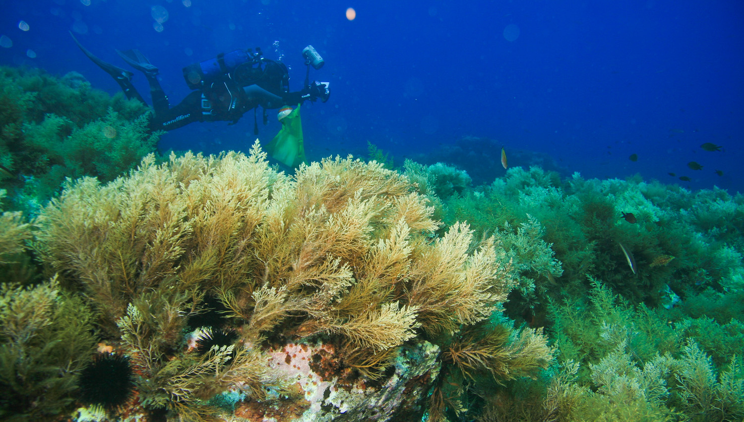
Quantification of the vegetation of Jabuka and Blitvenica, analysis of abiotic factors and model outputs will be used to assess oceanographic processes favouring the development of localised and very specific vegetation, starting with the hypothesis that localised upwelling of nutrient-rich water occurs. Investigation of plankton groups includes all trophic groups from pico- to mesoplankton sizes, both autotrophic and heterotrophic, that are included in all biogeochemical processes in the marine environment. Our assumption is that local U/D can significantly affect the structure of plankton groups and their role in the flux of carbon and energy to higher trophic levels.
Finally, a comparative analysis of all the results obtained will enable an integral picture of U/D to be formed.